Sunday, July 26, 2015

KEEN ON THE KENAI

Day 89 - 2015-07-18

We made the short journey from Anchorage to the Bird Creek Campground. 33 (11,304).  Bird Creek drains into the Turnagain Arm of the Cook Inlet. 

When we arrived, the fishing area near the mouth of the creek was muddy due to the high tide. We ate lunch and I decided to fish for a while.  By the time I got there, the tide had dropped another 5 or 6 feet, the bank was very muddy, but the creek was running crystal clear – about 20 feet wide and showing a nice channel.  There were MANY guys fishing the river, so I took off to join them.  The mud was AWFUL.  I sunk in to mid-calf – had to dig my wader boot out with my hand in order to move.  Finally I made it to the rocky river bottom.  As soon as I got there, a young girl tried to cross the mud and got stuck up to her thighs.  It took 3 guys to extract her, how they got out afterwards I don’t know because by then I was fishing.  This is called “combat fishing”.  Lots of people in a very small area – think 10 feet apart, on both sides of the river, with lines going everywhere.  Amazingly, there were few tangles and few lost fish.  I didn’t have to worry about that because I don’t think I ever got even close to a fish today.  It was an experience.  After I returned to the campground, I talked to a local guy who told me it was not recommended to venture into the mud.  He said every year, people get stuck in the “quick mud” and the local fire/rescue guys have to come get them out – that is, if the incoming tide holds off long enough for them to do so.  I don’t think I’ll try this again.

When I got back to camp, Bettie had spotted a herd of Dall sheep on a mountain across the way.  With Binoculars, we could watch their movement, although they were too far away to see any detail.  Still, pretty interesting to see how effortlessly they traverse what is almost vertical terrain.

The campground is very nice and the people camping here obviously have a sense of humor.  I don’t know how well it works as a camper, but it certainly is a sight to see.  I wonder if their last name is Jetson?


Day 90 - 2015-07-19
HOLY SMOKES – 90 DAYS ON THE ROAD.  We had no idea how this would go, if we could peacefully coexist in 200 square feet of living space and stand each other’s close company in the truck, or if we would be at each other’s throats.  Amazingly, we are still anxious for each new day to start so we can see what the next location has to offer.

We drove to Soldotna, AK today, the heart of the Kenai 
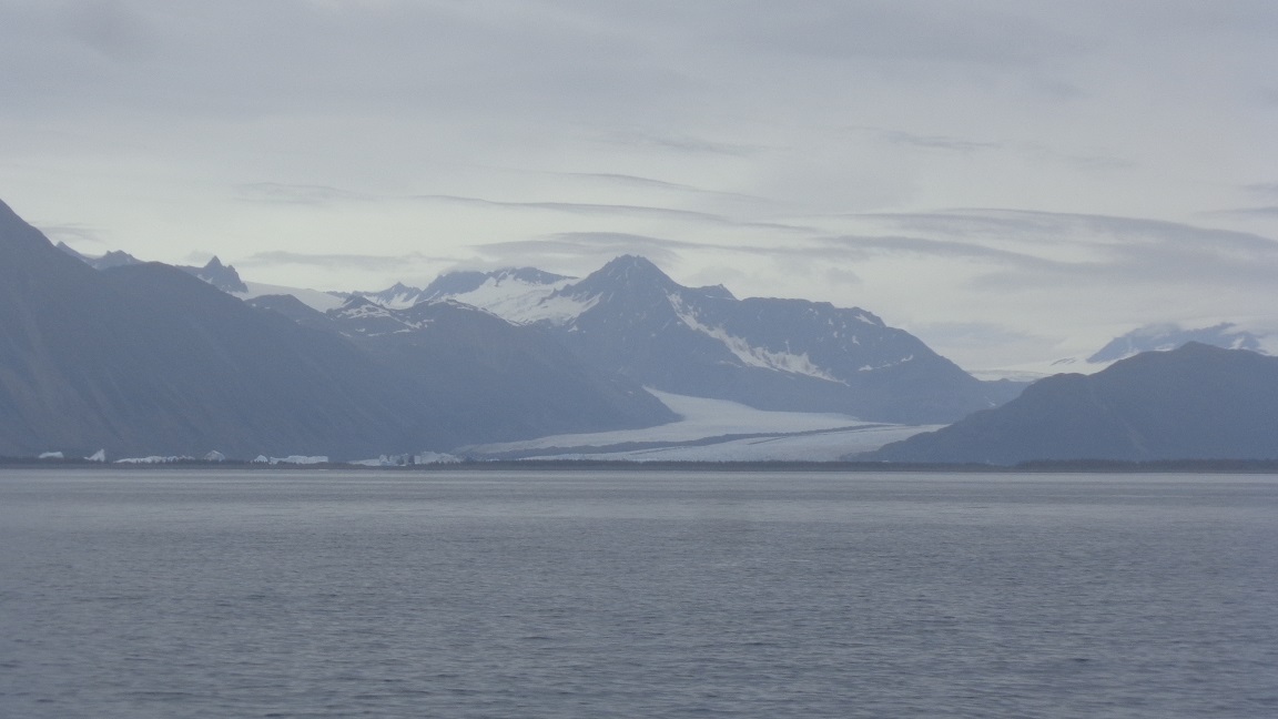
salmon fishery.  156 (11,460).  This trip took us around the top of Turnagain Arm, a glacial valley that is now covered with shallow water until it meets the Cook Inlet. 


At the top of the arm, we found the Portage Glacier and several others.


We got to Soldotna about noon and went directly to the Swiftwater Campground, a Soldotna City Park on the shores of the Kenai River.  Being a Sunday and arriving right at checkout time, we were lucky enough to get a place to park for a couple of days (most parks are completely full this time of year).  The park has a long river access so I tried my luck at salmon fishing this afternoon.  Nobody was catching much of anything, everyone said the run has not really started yet, but I did manage to hook one fish, which promptly spit my hook and swam away to spawn and die.  It would have been so much easier to let me catch it.

After dinner, we took a drive to the mouth of the Kenai River to watch dip net fishing, something that only Alaska residents are allowed to do.  This amounts to standing in the river, holding a circular net about 5 feet in diameter mounted on a pole, and waiting for a salmon to swim into it.  The whole process looked pretty boring and we didn’t see anyone actually catch a fish.  I’m sure they do quite well when the fish are running, the limit is 25 per adult per year, but today did not look like a very good day.

On the way, we saw a big male caribou with an absolutely HUGE rack.  Unfortunately, we left the camera in the camper, so no pictures to share.

Day 91 - 2015-07-20

What’s For Dinner?  SOCKEYE SALMON.  I met up with our mailman Jim H and a couple of his buddies today to fish for sockeye salmon.  They fish the run here every year and were gracious enough to show me the ropes and their honey hole.  We all got 3 fish limits. Here’s a picture of my 3.


We were done fishing and cleaning by about 10:00, so I had plenty of time to get the new puncture wound in the right front tire taken care of.  This gave us a chance to walk around Soldotna and check out some of the stores – the hardware store is something to behold – like a real hardware store should be.
We came back to the campground and found the river still full of hopeful fishermen – not as crowded as it was over the weekend, but still a lot of people trying to catch fish. 11 (11,471).

Day 92 - 2015-07-21

What a day this has been.  I started the day at 5:00AM.  Coffee and pastry at the Holiday gas station, then off to meet Jim & friends for another morning of fishing.  I was first to arrive, so I geared up and took off for the hole.  To access the honey hole, you have to walk along a narrow, muddy pathway.  I took one wrong step and sunk in the muck up to my thigh.  Stuck.  The harder I tried to get out, the deeper I sank.  OK, no way to get myself out.  As I resigned myself to the fact that I would just have to wait for help, the guys appeared on the path.  A few good tugs and a little leverage and my stuck leg finally came free.  We got to the hole to find another guy already there.  No problem, plenty of room for everyone.  Within about 30 minutes of fishing I had my second 3 fish limit of the trip, including one on the first cast.  Wow.  I can’t believe how good this hole is.  Thanks again to Jim H and friends for sharing with me.  This has been a really special part of the trip.

I got back to the trailer about 9:00 and we packed up.  Off to Seward.  We backtracked a bit on the Sterling Highway (AK 1), then picked up the Seward Highway (AK 9).  Our campsite is about 6 miles before town, so we stopped and got set up.

On the way to town, we turned off on the access road to Kenai Fjords National Park to see the Exit Glacier.  We got a good view of it from the road.


We’ll go back another day to take the hike to the viewing area.  This is probably the closest normal people can get to a glacier anywhere.  We are pretty excited about seeing it up close.

We drove into Seward to look around and waste some time.  What a cool town.  It is nestled in the top of a fjord, surrounded by mountains with glaciers all over them.  There is a nicely developed main street and a very busy harbor area that caters to fishermen and sightseers taking fjord tours and whale watching trips.

We stopped in to the Seward Brewing Company where both of us had their locally brewed red.  We liked it.  Afterwards, we walked the docks just as the fishing charters started coming in.  Unbelievable.  Tub after tub of halibut, ling cod, yellow eye, and silver salmon.  No kidding, we saw easily 500 fish, the largest being a 78 pound halibut, but I bet the days catch reached into the thousands. 128 (11,599).

Day 93 - 2015-07-22

We took the Major Marine tour of the Kenai Fjords National Park today.  12 (11,611).  We sailed from Seward on a 36 passenger boat, out to the Gulf of Alaska, to the Northwestern Glacier.  It was a long day, 8:30 to 5:30, which started out overcast and turned into intermittent rain by the time we reached the glacier.  Even so, the wildlife and landscape viewing were amazing – MANY glaciers along the way, humpback whales, sea otters, sea lions, puffins, and many more birds I am still unfamiliar with.  The scenery was spectacular. 


The Northwest Glacier is a tidewater glacier (meaning it terminates at the sea).  It is the bluest of any glacier we have seen.  We got within a few hundred yards of it.  Here are a couple of shots.


The highlight of the day was a breaching humpback whale.  I was lucky enough to get this shot of it (shot of a lifetime for me - very lucky).


Day 94 - 2015-07-23

We took it easy today.  We headed toward Seward, but turned off on Nash Road and followed it out to some overlooks of Seward from across the fjord.  Nice views of a different perspective on the town since the mountains on that side are much more wooded.  Our next stop was Lowell Point, the furthest you can drive down the fjord from Seward.  We walked on the “beach” (all ground up rock and flat stones like flint or slate) and enjoyed the views.  After a quick stop to buy a postcard, we made our way back to the Exit Glacier area of the Kenai Fjords National Park, where we hiked the 2 mile or so trail to the Edge of the Glacier Overlook.  This is pretty darn close to the glacier and was a beautiful sight.


Tonight’s cooking was supposed to be wings and tater tots.  The grill was doing fine until the gas ran out.  Oops, not a big deal but it cost a few minutes.  I put on a new bottle and, of course, it had more pressure so the fire burned hotter and the wings flared up.  Not a total disaster, but we had not planned on “blackened” wings.  About that time, Bettie discovered she had not turned on the oven, so the tater tots were still ice cold.  Oops, not a total disaster, but we had to eat the wings as an appetizer instead of the main course.  What then to do about dinner?  We have polish sausage, so on they go while we eat wings.  Yea, they didn’t burn and we finally got to eat.  Sometimes, Murphy just rules the day.  51 (11,662).

Day 95 - 2015-07-24

Today we drive to Homer.  181 (11,843).  The drive along the lakes leading into Seward and the Kenai River valley are some of the most scenic and beautiful of the entire trip.  The water in the Kenai River is a rich teal green, not clear, but very pretty from the mineral contained in the glacier runoff.  This is a major salmon river and there were lots of drift boats fishing along the way.


We went back through Soldotna and headed our toward Homer along the Cook Inlet.  The views of Mt. Iliamna


and Mt. Redoubt


were gorgeous.  These are about 50 miles away.

We stopped at Deep Creek, which is famous for its eagle population.  There is a VERY busy boat launching operation at the beach here.

 
The eagles come for the carcasses of the fish, which are everywhere along the beach.  They must have already had their fill by the time we arrived because we did not see a single one.  We’ll try again on our return trip.

Further along, we came to an overlook with an excellent view of the inlet.


We got a first row site at the Driftwood RV Park in Homer.


Homer is home to the Homer Spit, the longest natural spit in North America.  It is known as a place for RV'ers to camp while fishing the inlet for Halibut and Salmon.  It’s also pretty touristy in terms of the businesses there, kind of like a cruise ship town, but we think we’ll stay there a night just get the experience of it.


Day 96 - 2015-07-25


Today, I went Halibut Fishing. 11 (11,854).  The weather sucked, 4-5 foot seas, intermittent rain, windy and cold.  Perfect day to get the Homer fishing experience, so all 6 of us on the charter elected to go anyway.  Alaska allows you to keep 2 halibut, one of which must be 29 inches or shorter, no upper limit.  The biggest caught on the boat was about 70 pounds, mine went about 40 pounds.  Here’s the intrepid crew and our days bounty.  My fish are the second from the left.

Friday, July 17, 2015

ANCHORAGE


Day 87 - 2015-07-16

We made our way through LOTS of construction on The Parks Highway (AK 3) to Willow, AK.  No stops along the way today.  The weather returned to low hanging clouds and intermittent sprinkles.  The big mountain was totally socked in.  So, no need to dally.  We did, however, thank our luck stars over and over again for the great weather we had yesterday.  We stopped at the Willow Creek Resort, just north of Willow, AK where we got a campsite right on the creekside.  I spent some time fishing the creek, but it is between the king salmon run and the chum & silver run.  I didn’t expect to have any luck, and I was right.  178 (11,167).

Day 88 - 2015-07-17

On to Anchorage today.  The drive took us through Wasilla.  We took a picture of these big mountains in the background.  We think they must be in Russia.


We camped tonight at the Centennial Park Campground, a nice municipal campground on the Glenn Highway (AK 1), just before getting to Anchorage proper.  We spent the day doing errands, but on our way out of the campground, we came across a black bear and her cub in a couple of trees in the park.  Mom is pretty obvious, cub is the dark lump at the top of the tree, apparently sound asleep.


Here’s a short video of the Mom chowing down on something that must have been exceedingly good.


We went into town to look around and have dinner.  Not much to look at here, at least from what we could see.  We had fresh salmon and sampled some of the brews from the Sleeping Lady Brewery.  All good.  104 (11,271).

Thursday, July 16, 2015

DENALI

Day 81 - 2015-07-10
We left Fairbanks today bound for someplace between there and Denali National Park.  We have a few days to kill so we will spend them exploring the upper part of the Parks Highway (AK3).  We stopped at the Tatlanika Trading Post and RV Park at the crossing of the Nenana River. 

We walked around the riverbed a bit, but essentially took another day off.  Bettie used the time to do some research and trip planning.  125 (10,641).


Day 82 - 2015-07-11
I’m sitting inside the nice dry camper, typing this blog post, while it is raining outside.  We moved today to Byers Lake in the Denali State Park (no, not the National Park, this is a state park just down the road).  This was recommended to us by Larissa and Trey, the Alaska natives we met back in the Clearwater River Campground outside Delta Junction.  They steered us right.  The lake is clear, small, and calm – just the way we like them for kayaking.  We hit the water this afternoon.


The trip down here took us past the entrance to the Denali National Park, where we will be in a few days.  Getting here required several stops for construction and pilot car lines.  As I mentioned several days ago, we think the new Alaska Gold is RV traffic.  Here’s a picture of the line waiting for the pilot car.  You can draw your own conclusions.


We also drove past the iconic Igloo.  This was built in the 70’s and was intended to be a hotel and RV campground.  Apparently, even in the 70’s, this part of Alaska had building codes, and the Igloo did not make the grade.  It has fallen into disrepair and just sits on the Parks Highway as another fool’s folly.  If you are interested, it is for sale - only $300,000 – we declined to make a counteroffer.


We stopped along the way to look for Denali (Mt. McKinley, same thing).  Although we had pretty clear skies above us, the mountain was making its own weather and we did not get a good look at it today.  We did spot one very large glacier, which we later learned is the Eldridge Glacier.  I liked it because all the “gray” ice is really that amazing glacier blue – too bad it didn’t really show up in the picture.


After our stops, all went well until we tried to find our campground.  With all the construction, the sign was down and we missed the turn.  OK, no big deal.  Except, OOPS, just after the turn there was another flagman and pilot car line.  No place to turn around.  We had to follow another pilot car for another 5 miles until we could find a place to reverse direction.  Frustrating, but could have been worse.  We were happy to find this nice place to camp.  We’ll be here today and tomorrow, then make our back through the construction to find our next RV park.  That will be our home for a few days while we tour Denali National Park.  152 (10,793).

Day 83 - 2015-07-12
We tried our best today to see Denali.  We drove back to the Denali State Park North Viewpoint, but no luck.  The clouds are just too low and too thick.  We consoled ourselves with a 3 hour kayak around Byers Lake. Oh darn, what an awful alternative.  On a clear day, Denali is a spectacular sight from the lake (check the internet for Denali Pictures from Byers Lake) but it was not in the cards for us today.  We have a few more days in the area, so we still have hope.  27 (10,820).

Day 84 - 2015-07-13
We left Byers Lake this morning about 9:00 and as we got to the highway, we got the best view of Denali we have had so far.  Look closely, the peak is above the cloud.


We backtracked north on the Parks Highway (AK 3), past the entrance to Denali National Park, through several construction delays, past the Denali RV Park and Motel where we will stay tonight, until we got to Healy, AK and some much needed diesel.  Fortunately for us, we found the 49th State Brewing Company right next to the fuel station.  Food and craft beer sounded pretty good so it was halibut sandwiches washed down by a Baked Blond for Bettie and a Vienna Amber Lager for me.  Thumbs up for all of it.  It’s really nice to visit a tourist destination where the food is actually above average instead of “tourist tolerable”.  The brewery owns the bus that was used in the making of the movie Into the Wild.  111 (10,931).


Day 85 - 2015-07-14
It was a stormy night that continued into this morning.  We hung out in the trailer until about 11:30, then decided we should at least drive into the park.  Tomorrow we are taking a 12 hour bus tour and our pickup time is 6:40 AM.  We needed to check out how long it will take us to drive the 6 miles through the several construction zones between here and there.  We figure 45 minutes should do it, so we’ll get at least some sleep.  Sun up is about 4:30 (yes, we are far enough south to get an hour or so of actual darkness at night) so that will make it easier.  There was no way to see any of the mountains with the bad weather, but, we saw a humongous bull moose in the park today.  He was too far away for a very good picture.  Maybe we’ll have better luck tomorrow. 45 (10,976). 

Day 86 - 2015-07-15
Denali Tour Day.  It was raining when we got up at 5:00 AM to get ready for our tour.  Oh well, you take what you get weather-wise so off we went to our pickup location.  By the time we reached the park, it was still overcast and drizzling.  By the time we got about 25 miles in, we reached the edge of the weather front just as it started to clear over Denali/Mt McKinley.


The closer we approached, the clearer it got, until we got a full view of the mountain and both peaks. 


The tour guide said this is a 5% day – some of the best viewing ever.


To give you some idea about how big this thing is, it is 85 miles from where I took these pictures and it still dominates the landscape – 20,320 feet.


We also had a stellar day in terms of wildlife viewing – 9 grizzly bear sightings, many single and an entire herd of caribou, and many moose sightings. 


The landscapes in the park are remarkable.  We were so fortunate to get such a perfect day for our tour.  Some of the mountains in these pictures are over 100 miles away.


As we came back to our starting point, the skies clouded over and we got some rain again, but it did give us a nice rainbow, a fitting end to a very good day. 13 (10,989)


Thursday, July 9, 2015

THE STEESE, CHENA HOT SPRINGS, ELLIOTT, AND DALTON (THE HAUL ROAD) HIGHWAYS

Day 72 - 2015-07-01

We had an interesting day today.  We left the Riverview RV Park in Fairbanks.  Our first stop was to visit the viewing site of the Alaska Pipeline. 
I got my picture taken with the pigs.


The pipeline itself, where it is above ground like this, is insulated against the 100* heat of the oil inside.


We left the pipeline and headed for the Northern Moosed RV Park in Fox, AK, about 11 miles up the road.  We have reservations here for a 7 day stay and needed to make arrangements to receive a package from home.  We pulled into the place and I almost puked.  This place looked like the run down dump in Stewart Junction where I fought off the mosquito hoard so I could dump and water.  No way were staying here.  We turned around and drove out of the lot.  The next couple of hours were spent on the side of the road changing arrangements for the next several days.  All turned out well and we took off for our next campsite.

We continued up the Steese Highway (AK 2) to MM39 where we found the Chatanika River Campground.  UNBELIEVABLE.  On this beautiful little river, and we are the only campers here.

I geared up


And spent an hour and a half fishing.  No luck, but what a great place to get skunked.


 Our campsite is on a little rise and has a nice view of the river.

The only downside was the mosquitoes.  They were as thick as any place we have ever been.  But we came prepared and still enjoyed an afternoon on the river.


We talked a lot today about how we are doing this trip.  We have met a lot of folks, mostly at the big RV Parks, who travel from destination to destination, or attraction to attraction, and see only the road in between.  For many, it’s a function of time, for some it’s just what they do.  We look back on our trip at the MANY nights we have just turned off the road and stopped in some remote place to boondock.  Because we have gone “behind the tree line”, we feel like we have had a much richer experience.  I’m sure our way is not for everyone, but we are having a great time here in the boonies.  55 (9,222).

Day 73 - 2015-07-02

We awoke from an all-night rain to find today gloomy.  We piddled around trying to decide what to do.  We could continue up the Steese Highway (AK 6) to another campground, but with the weather socked in like it is, we decided to forego that option – couldn’t be much better than where we are and we can’t see much from here.

We decided to move to Olnes Lake, a stocked lake about 11 miles up the Elliott Highway (AK 2).  Our trip back down the Steese took us up to about 1,900 feet where we entered the clouds, by 2,100 feet I could barely see beyond the hood.  We rolled up to road construction and waited for the pilot car.


Olnes Lake turned out to be a hot spot for kids on ATV’s.  We set up camp, but after seeing the commotion around the lake and more people pulling in for the long weekend, we packed up and left.  What I said about that “behind the tree line” thing works both ways I suppose. 

We drove to the Chena Hot Springs Highway and stopped at Rosehip Campground on the Chena River.  The weather is still “low” and the air is heavy.  But, the river looked beautiful with its low hanging mist/fog/cloud/whatever it is – maybe there’s a hidden hot spring around the bend of the river? – the “fog” never moved closer to us than what is in the picture.

In any case, I fished all of the river I could reach from the sandbar and, as usual, caught nothing.  But I did see a bunch of bear prints on the bar, so maybe a sighting will be in our future.  83 (9,305).

Day 74 - 2015-07-03

No bear sightings last night or this morning so we decided to move on to a new location today.  Before we left, we continued up the road to the Chena Hot Springs Resort.

This is a beautiful setting, rustic buildings, lots of flowers, but it was a LOT of “resort”.  Not our cup of tea, so we didn’t stay too long.
On the drive back, Bettie spotted a moose cow on the side of the road.  She must have been used to the attention, because we stopped within about 30 feet and she was completely unconcerned about us.  Gave us a chance to get a good picture.


This afternoon, we checked back into the Riverview RV Park between the North Pole and Fairbanks.  We’ll be here for 6 nights, two of which we will spend driving the Dalton Highway to Deadhorse/Prudhoe Bay.  This is also known as the “Haul Road” and was made famous by the TV series Ice Road Truckers.  We won’t encounter those conditions, but have heard it is a rough 400 miles each way.  It promises good wildlife viewing and will be my only chance to dip my toes in the Arctic Ocean – I can’t wait!

Tonight we visited two area icons in Fox, AK, just north of Fairbanks on the Elliot Highway, the Silver Gulch Brewing and Bottling Co. and The Turtle Club.  The brewery is “America’s Most Northern Brewery” and was a pleasant upscale surprise.  Bettie had the Northern Light (described by our beer wench Mandy as the craft beer version of Bud Light) and liked it very well.  I tried the Fairbanks Lager (good) and the Old 55 IPA (better).  The Turtle Club is a 60’s vintage restaurant (rough cut cedar paneling, recessed lighting, a salad bar, a three bowled condiment tray for every table, and our waitress brought around the desert selections on a big tray she balanced somehow while she explained each one).  The main menu consists of three sizes of prime rib (large, larger and way too big), complete with a baked potato and mandatory trip to the salad bar.  There was some other stuff to choose from, but when half the menu is dedicated to prime rib, I’m thinkin’ it’s the best bet.  It was good food and it was really a hoot to experience again how things used to be.  What made it so fun was that they weren’t trying to make it like a 60’s restaurant – it just is one. 137 (9,442).

Day 75 - 2015-07-04

The Fourth of July !!!  We spent the day in Fairbanks.  First stop was the Tanana Valley Farmers Market.  We, unfortunately, did not get to see one of the famous Fairbanks 80# cabbages, but we did get a little taste of home in the form of Texas Tacos by Lane, complete with seasonings directly from San Antonio where he was stationed in the Army.  Yes, they were a welcome treat.


After lunch we went to Pioneer Park to check out the celebration.  We got there in time to hear them read the entire Declaration of Independence, something I thought was pretty cool, and had never seen done before.  We walked around a bit then went to Fred Meyers for some shopping.  Back at the campsite we just sat outside and enjoyed the perfect weather.  Had a long chat with a campmate from Switzerland, who is touring Canada and Alaska in a motorhome for 6 months.  We talked about doing the same in Europe and got some good information from him.  Not much else to report so I’m calling it a day.  FYI, Fairbanks is getting 22 hours of daylight right now – SOOOOO Weird.  30 (9,442).

Day 76 - 2015-07-05

We went to Walmart today, then hung around the RV park and took care of some truck and trailer maintenance.  22 (9,464)

Days 77 to 79 - 2015-07-06 to 08
THE DALTON HIGHWAY, THE HAUL ROAD.  1,022 MILES FROM FAIRBANKS TO DEADHORSE AND BACK. MY BIG CHANCE TO DIP MY TOES IN THE ARCTIC OCEAN.

The road to Deadhorse is touted as one of the most difficult and dangerous roads in Alaska.  The halfway point is Coldfoot Camp and the nearby village of Wiseman, where we stayed the first night.  The drive was rough, a combination of bad asphalt, hardpack clay, and gravel.  The only real problems were the potholes.  These could be washouts in the gravel or sink holes in the asphalt, which were the worst ones.  Otherwise, it was a pretty comfortable 45mph road. 

As you might imagine, this road is ALL ABOUT the pipeline.

We stopped for lunch at an overlook that gave us a great view of one of the big forest fires burning in this area.


The road down was lined with Fireweed.  This stuff is beautiful, and grows in huge meadows all along this part of the road - you can see some in the picture above.


Our first big waypoint was the Arctic Circle.


We looked for wildlife all the way up and back.  The most significant sighting was this bull moose.  He was a LONG way off, so sorry for the picture quality.


We arrived in Coldfoot pretty much unscathed.  It’s not much to look at, but it had fuel ($5.499/gal) and an excellent buffet.


We stayed in Wiseman, a few miles up the road, and completely off the grid.  It has its own vibe.


The next morning, we took off for Deadhorse.  The first big event of the trip was scaling Atigun Pass (4,800 feet).

The scenery up to Atigun and for a number of miles beyond was the most beautiful of the drive.


By the time we approached Deadhorse (it’s the little line of white buildings on the horizon), the landscape had turned to tundra.  

We celebrated making it to the end of the Dalton Highway with a quick picture. 


We explored Deadhorse and got some fuel ($5.899/gal) and some lunch, another excellent buffet at the Aurora Hotel.  Deadhorse has no purpose other than to support the North Slope drilling.  This is the most industrial looking place you can imagine – row after row of big, expensive equipment and thousands of people to operate it.  And to make it worse, there is no paving. While we looked around, the weather changed into a major storm, rain and a 50mph wind, so, the grit was really nasty.  Oh, it also got cold, 38*F – wind chill was colder than we cared to think about.

We took the tour out to Prudhoe Bay (the only way to access the Arctic Ocean).  I was the only one who braved the water – and I have a picture to prove it!


After the tour, we headed back to Wiseman.  Seeing the road from both directions was a treat because the scenery was very different each way.  The “Sag” River has some of the bluest river water we have ever seen.


All went well until we approached Atigun Pass.  We had been in rain most of the way back, but the pass was totally socked in – visibility about 1 car length.  We had to slow to 15mph for most of it, but caution paid off and we are here to tell about it.

Our take away from this side trip is that we are really glad we did it ONCE, don’t see any reason to do it again.  The road is not as bad as the guide books lead you to believe, again, more hype than horror.  We did take a few pretty hard shots from potholes and the truck now has a permanent reminder of the trip in the form of a rock ding on the chrome grill – we’ll just refer to it as a badge of honor and let it be a reminder of the trip. 

Day 80 - 2015-07-09

After making Deadhorse and back in two days we took a down day today.  Washed about a ton of mud off the truck, then worked on the blog.  Hope you enjoy. 0 (10,516).